Thailand and its unilateral maps of the border dispute – the back story revealed
 Thailand and its unilateral maps of the border dispute – the back story revealed
This Opinion aims to inform the public of how Thailand’s unilateral maps have become the center of controversy and the bottleneck for the peaceful settlement of the border with Cambodia.
In the judgment of the International Court of Justice in 1962, one of the main points of contention was whether Thailand had accepted the Annexe I map.
During the merits phase of the proceedings, Cambodia relied upon the above-mentioned map entitled “Dangrek Commission of Delimitation between Indo-China and Siam”, which was annexed to its pleadings and was referred to as the “Annexe I map”. Cambodia argued that this map had been accepted by Thailand and had entered into the treaty settlement, thereby becoming binding on both states. According to Cambodia, the line shown on the Annexe I map had thus become the frontier between the two States.
The Court considered that Thailand in 1908-1909 accepted the Annexe 1 map as representing the outcome of the delimitation work, and hence recognised the line on that map as the frontier line, the effect of which is to situate Preah Vihear in Cambodian territory.
The Siamese authorities, by their conduct, acknowledged the receipt. They recognised the character, of these maps, and what they purported to represent, was shown by the action of the Minister of the Interior, Prince Damrong, in thanking the French Minister in Bangkok for the maps, and in asking him for another fifteen copies of each of them for transmission to the Siamese provincial Governors.
Based on these considerations, the International Court of Justice (ICJ) rendered its judgment in 1962, ruling that the Temple of Preah Vihear is situated in territory under the sovereignty of Cambodia.
Following the delivery of the 1962 Judgment, Thailand withdrew from the Temple buildings. It erected a barbed wire fence which divided the Temple ruins from the rest of the promontory of Preah Vihear. This fence followed the course of a line depicted on the map attached to a resolution, adopted by the Council of Ministers of Thailand on 10 July 1962, but not made public until the proceedings in 2011.
Since 1962, Thailand has continued to use its unilateral map in contesting Cambodia’s border claim.
No one knows how many such unilateral maps Thailand has, but what is clear is that those unilateral maps have no legal value or binding force in accordance with international law.
While any nation can draw a unilateral map as it pleases, whether such a map would gain international recognition, thereby affecting border delimitation and demarcation, is a different matter entirely.
In the case of the border between Cambodia and Thailand, Cambodia has never accepted Thailand’s unilateral maps. If Cambodia were to follow Thailand, the former would have drawn its own unilateral map to cover provinces that Cambodia deemed had been lost to Thailand. But such has never been the case.
Thailand’s insistence on using its unilateral maps has hindered the border negotiation process.
Based on such unilateral maps, which have no legal value, Thailand accused Cambodia of encroaching its territory.
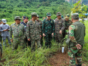
On 9 June 2025, the Royal Thai Armed Forces (RTARF) presented aerial photographic evidence, asserting that the Chong Bok area is within Thailand’s border.
RTARF explained that the map used by Cambodia as a reference is a 1:200,000 scale map, attached to the Franco-Siamese Treaty of 1907.
Thailand, on the other hand, uses a 1:50,000 scale map, referencing the L7018 map series, which is highly detailed. Based on aerial photographic evidence, the armed forces stated that it is evident that the Chong Bok area is within Thailand’s borders.
It should be recalled that in the dispute related to Preah Vihear in 2007, Thailand produced a copy of its L7017 map.
So, from L7017 to L7018, no one really knows how many maps Thailand has produced independently.
If Thailand is so confident about the legality of its unilateral maps, why is Thailand always afraid of the International Court of Justice?
Thailand recognises that its unilateral maps have no value or binding effect under international law, and therefore, it has consistently urged Cambodia not to proceed with the ICJ.
Thailand’s unilateral maps have been the source of eventual armed conflicts. It used unilateral maps to encroach on Cambodian territory and accused Cambodia of encroaching on its territory.
The two countries should demonstrate sincerity and pursue transparency by the law. The two countries should not be afraid of the ICJ, given that they are staunch proponents of international law and the rule-based international order.
Creating unilateral maps is far from being a responsible member state of the international community.
With its unilateral maps, it is clear that Thailand is afraid of the ICJ, of international law, and has a hidden agenda to claim other countries’ territories based on strength.
The author is a Phnom Penh-based geopolitical and security analyst. The views expressed here are the author’s own.
Source: Khmer Times